




East Coast Braces as Rapidly Intensifying Nor’easter Targets Mid-Atlantic

Key Takeaways
- A fast-developing nor’easter is tracking along the Mid-Atlantic and Northeast corridors, threatening widespread coastal flooding, intense precipitation, and gale-force wind gusts.
- New Jersey officials have instituted a state of emergency across eight vulnerable counties in anticipation of severe weather impacts.
- Metropolitan hubs including New York City, Philadelphia, and coastal communities along the Jersey Shore are on alert for infrastructure disruptions and power outages.
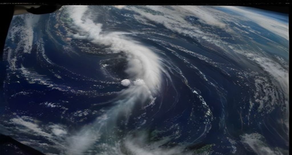
Communities across the Eastern Seaboard are reinforcing coastal barriers and readying emergency operations as a deepening nor’easter tracks upward from the Atlantic, threatening millions with disruptive storm surges, heavy precipitation, and utility interruptions. According to comprehensive meteorological tracking first detailed by The Washington Post, the low-pressure system is undergoing rapid intensification as it churns near the shoreline, setting up a severe weather window for both coastal zones and densely populated inland transit corridors.
Meteorologists warn that the convergence of unseasonably moist maritime air with a colder continental airmass will generate severe weather bands capable of producing localized flash flooding and marine hazards. Regional forecasts indicate that the heaviest combined impacts – characterized by sustained gale-force winds and repeated tidal inundation – will likely hammer coastal New Jersey, the Delaware shoreline, and the outer boroughs of New York City through the weekend.
SPONSORED ADVERTISEMENT
Regional Declarations and Severe Coastal Flooding Risks
In response to the deteriorating atmospheric profile, state leaders have begun implementing preemptive safety mandates. As initially confirmed by state emergency management officials to regional outlets and The Washington Post, New Jersey leadership declared a formal state of emergency spanning eight coastal and southern counties. The emergency measure mobilizes National Guard resources, facilitates inter-agency logistical coordination, and empowers transportation departments to enforce highway restrictions if rising tides submerge arterial roadways.
Low-lying shoreline communities face multiple high-tide cycles under persistent onshore wind flow. Coastal water levels are forecast to rise several feet above normal astronomical baselines, raising immediate concern for the Jersey Shore, Long Island sound basins, and lower Manhattan marinas. Officials have urged residents living in repetitive-loss flood areas to secure ground-level belongings, elevate vehicles, and closely monitor municipal evacuation guidelines.
SPONSORED ADVERTISEMENT
Grid Vulnerability, Commuter Delays, and Urban Impacts
Beyond the water threat, atmospheric pressure falls associated with the storm center are fueling powerful wind gusts expected to exceed 50 mph along exposed stretches of coastline. These winds threaten to topple saturated tree canopies onto residential power feeders, presenting a considerable risk of localized electrical blackouts across southeastern Pennsylvania, the New York Tri-State zone, and down through coastal Maryland.
Regional transit authorities, including commuter rail systems and municipal bus carriers, have initiated contingency operations to clear drainage channels and ready track clearing apparatus. Aviation hubs – notably John F. Kennedy International, LaGuardia, Newark Liberty, and Philadelphia International – are bracing for potential departure delays and runway ground halts as peripheral bands of rain and crosswinds intensify over the Mid-Atlantic air corridor.
SPONSORED ADVERTISEMENT
Frequently Asked Questions
Which metropolitan areas face the highest risk from this nor’easter?
The highest direct impacts are centered on the Philadelphia metropolitan area, coastal and central New Jersey, New York City, and Long Island. These regions face an overlapping threat of torrential rainfall, gale-force winds, and moderate-to-major coastal flooding during successive high-tide windows.
What steps should residents take to safeguard property during the storm?
Residents in low-lying zones should relocate automobiles to elevated parking facilities, clear exterior storm drains of autumnal debris, charge critical battery-powered communication devices, and assemble basic emergency kits featuring non-perishable food, flashlights, and freshwater reserves in case of utility disruption.
Reported by Creek Observer Editorial Desk. Sourced and verified from public news dispatches including The Washington Post. Published in accordance with fair reporting and public interest standards.