




Category 5 Hurricane Polo Threatens Mexico and Southwest Floods
Key Takeaways
- Hurricane Polo has rapidly intensified into a dangerous Category 5 storm over the Pacific.
- According to reporting from USA Today, the cyclone is projected to strike Mexico before injecting moisture into the U.S. Southwest.
- Local officials in coastal regions are aggressively scaling up flood preparations and emergency infrastructure.
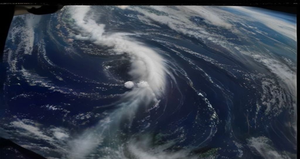
The Pacific basin is experiencing an extraordinary surge in severe tropical weather activity, highlighted by the explosive strengthening of Hurricane Polo. Recent updates shared by USA Today detail how the storm has scaled to maximum Category 5 status, alarming meteorologists who track rapid intensification patterns driven by ocean temperatures. This meteorological event places coastal communities on high alert as the colossal system maps a trajectory toward land.
NASA and various climate reporting networks, including Yale Climate Connections, note that the broader Pacific cyclone factory is operating at an unprecedented pace this season. Multiple swirling storms underscore a hyper-active cycle that experts tie to persistent warm sea surface anomalies. As Hurricane Polo harnesses this immense thermal energy, its wind profiles and moisture output have expanded exponentially.
SPONSORED ADVERTISEMENT
Regional Impacts and Preparations
Down the coast, municipal agencies are taking no chances. In Southern California, departments like Long Beach emergency services are reviewing coastal flood defenses, securing infrastructure, and advising residents on emergency readiness. Although the direct core of the cyclone targets Mexico, the peripheral hazards extend hundreds of miles outward, generating powerful swells, dangerous rip currents, and coastal erosion risks.
Forecasters at FOX Weather warn that once the system makes landfall and tracks inland, its remnant moisture will be scooped up by steering currents. This process threatens to unleash heavy rainfall and renewed flash flooding across portions of the American Southwest in the coming week. Desert communities that typically experience dry conditions must now brace for sudden, torrential downpours.
SPONSORED ADVERTISEMENT
Understanding Rapid Intensification
The transition of Hurricane Polo into a top-tier storm highlights a growing challenge for modern disaster response: unpredictable and explosive strengthening. When storms pull energy from deep, warm ocean layers, forecasting models sometimes struggle to capture the speed at which barometric pressure drops. This phenomenon shortens the window for local authorities to evacuate coastal zones and fortify properties against severe wind and water damage.
Emergency management specialists continue to monitor real-time satellite feeds and NOAA reconnaissance flights. Citizens living along potential flood corridors are encouraged to keep updated through local weather advisories and review their family emergency kits before the severe weather arrives.
SPONSORED ADVERTISEMENT
Frequently Asked Questions
Where is Hurricane Polo currently heading?
According to current tracking data cited by USA Today, Hurricane Polo is moving across the Pacific toward an impending landfall in Mexico, with its trailing atmospheric moisture expected to impact the U.S. Southwest next week.
What makes Hurricane Polo so dangerous?
Polo reached Category 5 status due to explosive intensification fueled by warm Pacific waters. This intense power brings destructive winds, dangerous coastal storm surges, and extensive inland flooding threats.
Reported by Creek Observer Editorial Desk. Sourced and verified from public news dispatches including USA Today. Published in accordance with fair reporting and public interest standards.